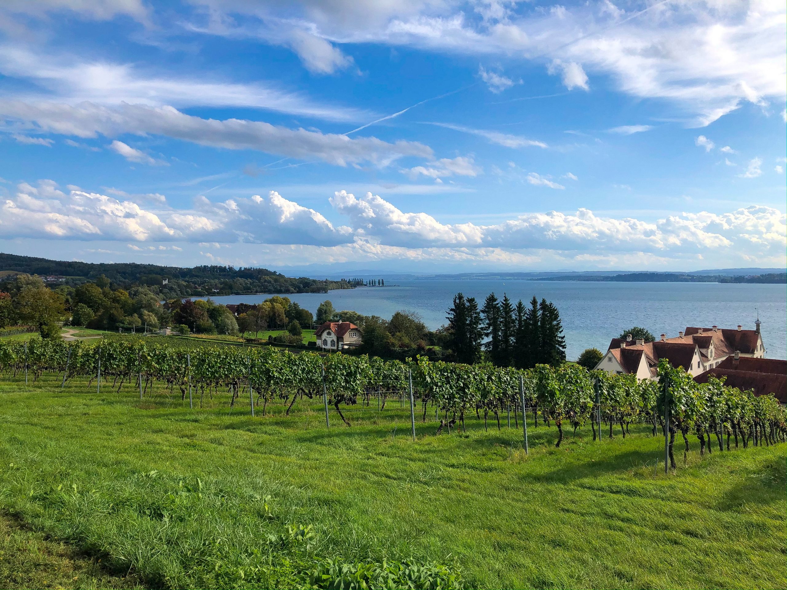
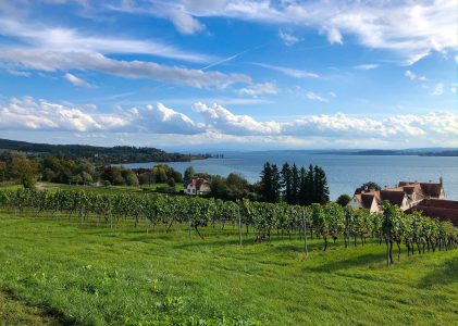
Constance

The largest city on Lake Constance is located on both the Obersee and the Untersee, connected by the short Seerhein, which gently flows along the two large parts of Lake Constance.

The city spreads out in two completely different appearances to the left and right of the Rhine. While modern districts and quiet residential areas alternate with large commercial zones in the north, one of the best-preserved old towns in Europe lies south of the great river.

The cultural, culinary and architectural offer in the narrow streets of the old town is unparalleled.

During the Second World War, the old town was spared from the Allied bombs. To this day, visitors from all over the world enjoy the beautiful old town ensemble, can visit cozy pubs and wine bars or take advantage of the wide range of cultural activities in one of the clubs, in cinemas or in the city theater.

The Cathedral of Our Lady rises above the roofs of the city, so you cannot miss it. Erected in just 40 years, it was once the center of the largest medieval diocese north of the Alps.

The Gothic appearance of the three-aisled column basilica mainly dates from the 15th century. Inside, the more than 1,000 year old crypt and the Mauritius rotunda with the holy grave are particularly worth seeing.

After years of renovation work, the cathedral tower is also accessible again (it will be rebuilt again in 2016 and should be accessible again from May 2016).

When walking through the old town, the former fishing district "Niederburg" is particularly noticeable. The colorful facades and the narrow streets are almost reminiscent of Mediterranean districts.


The most important event in the history of Constance was the council from 1414 to 1418, at which Pope Martin V was elected as the sole Pope of the Catholic Church.

The large building at the port, actually built as a department store, became known as the council building.

Opposite this is the Imperia by the sculptor Peter Lenk, almost like the figurehead of the port of Constance at the end of the pier. The controversial lady carries the lightly clad king and pope on her hands and is supposed to symbolize the not inconsiderable role of courtesans during the council.

The large Sea-Life aquarium is located very close to the port on an artificial peninsula in the lake and attracts with numerous pools that simulate the course of the Rhine from its source in the Alps to its mouth at the port of Rotterdam. The main attraction is the glass Mediterranean tunnel.

Path description

You leave the old town along the railway line over the old Rhine bridge. On the other side of the Rhine, the signposted cycle path turns right after the bridge in the direction of Meersburg and continues along the Seestrasse and the subsequent promenade along the lake until the latter ends.

Do not follow the riverside path, which is closed to cyclists, but turn left into Hebelstrasse, shortly afterwards right again and along Eichhornstrasse towards Hörnle, the large (free!) Lakeside swimming pool in Konstanz.

Shortly before that, the road bends to the left and now runs as Jakobstrasse through the forest into the nearby Staad district.

At the ferry to Meersburg, the Lake Constance cycle path turns briefly to the left, then immediately right again into Hoheneggstrasse.

The next step is closer to the lake, past the Ruppan brewery to Egg. Cycle out of the district on Mainaustrasse and continue on Graf-Lennard-Bernadotte-Allee to the entrance to the island of Mainau.
you roll on fairly comfortably, zigzagging through Litzelstetten and through the Fließhorn nature reserve to Dingeisdorf and the nearby Wallhausen.

Here, as in Dingelsdorf, there is again the possibility of crossing over to the northern bank by ship.

From Wallhausen, the Lake Constance cycle path becomes really mountainous for a short stretch. The Bodanrück gets in the way.

Since the shoreline is reserved for hikers and is forbidden for cyclists (which is clearly indicated by signs and revolving gates), only the path over the almost 700 meter high ridge remains.

Of course, you don't have to go to the highest point, but you still need a little breath.

The marking runs along the country road via Dettingen to Langenrain).

Shortly after Dettingen, instead of following the sign to Rahnhauser Hof along the road, and from there to Langenrain.

But the alternative route is even nicer, which leads from the end of Wallhausen at the Eulenbach car park on a gravel road to the right into the forest. Following the signs, you meander along fields, then back through the forest. Keeping to the left at Burgfeldweg, you will soon reach the road to Langenrain.

To the right of this now continue on the bike path into the village.
Racing cyclists better follow the main route and continue along the country road to Liggeringen. On the bike path that runs alongside the road, the descent from Liggeringen to Güttingen is a real pleasure and an ideal cool off on hot days. You cycle through the Radolfzell suburb to the B34.

After the underpass turn right and drive along the main road to Stahringen and on to the junction to Bodman.

Again the B34 is crossed, now through an underpass, and cycled on the local driveway to the small chapel at the entrance to Bodman.
All of the above routes meet at the chapel on the western outskirts of Bodman.

The place is left over the street "Im Weiler" in the direction of Ludwigshafen. Turn right at the sports center and cut the curve of the road on a gravel path across the Aachried nature reserve. Ludwigshafen is reached along the railway.

Passing the harbor, it goes through the village and on a specially created bike path along the old B31, always close to the lake, to Sipplingen.

At the train station, turn left into the actual center of the pretty village and pedal properly uphill to the Narrenbrunnen. Turn right and continue uphill until the cycle path on the outskirts leads back downhill through orchards with a wonderful view of the lake and the Alps to the shore.

Attention: Many cyclists use the busy and narrow quayside road through Sipplingen, which is not entirely harmless. This saves the climb but is not recommended.

Past the Süßenmühle pumping station on the valley side, the Lake Constance cycle path now leads back along the shore.

Überlingen will soon be reached via Goldbach.

The marking follows the busy Bahnhofstrasse. It is better to stay to the left of the tracks at the level crossing and only switch to the official route again at the Bodensee-Therme.

Variation: The variant "halfway over the mountain" to the Süßenmühle is even nicer. Instead of going down to the right on the outskirts of Sipplingen, turn left and drive past the sports field on a wide terrace below the steep castle hill.

On the way, signs point right to the peculiar Churfirsten. The rock towers have escaped the constant process of weathering because they wear a cap made of hard rock that protects them from rain like an umbrella.

A little further on you can take a detour on foot to the left into the beautiful "Hödinger Tobel" gorge, before this path finally joins the cycle path along the riverside road.

On it as previously described to Überlingen.
Official representation of the Lake Constance cycling path